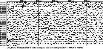
Earthquake Details
man beachte die Tiefe:187.9 km (116.8 miles) !!http://www.oe-files.de/gmaps/eqmashup.html * This event has been reviewed by a seismologist.
Magnitude 4.8
Date-Time
* Wednesday, July 28, 2010 at 08:07:09 UTC
* Wednesday, July 28, 2010 at 04:07:09 PM at epicenter
* Time of Earthquake in other Time Zones
Location 6.961°N, 126.625°E
187.9 km (116.8 miles)
Region MINDANAO, PHILIPPINES
Distances 110 km (70 miles) E of Davao, Mindanao, Philippines
160 km (100 miles) SSE of Hinatuan, Mindanao, Philippines
185 km (115 miles) ENE of General Santos, Mindanao, Philippines
1050 km (650 miles) SE of MANILA, Philippines
Location Uncertainty horizontal +/- 14.9 km (9.3 miles); depth +/- 28.1 km (17.5 miles)
Parameters NST= 42, Nph= 42, Dmin=689.1 km, Rmss=0.77 sec, Gp=126°,
M-type=body wave magnitude (Mb), Version=6
Source
* USGS NEIC (WDCS-D)
Event ID us2010zgal