sentex
Diskussionsleiter

Profil anzeigen
Private Nachricht
Link kopieren
Lesezeichen setzen
dabei seit 2008
Profil anzeigen
Private Nachricht
Link kopieren
Lesezeichen setzen
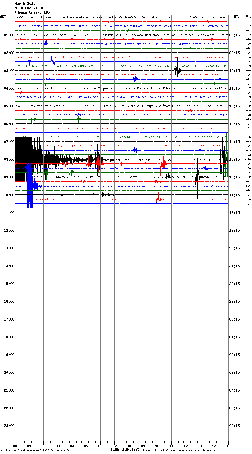
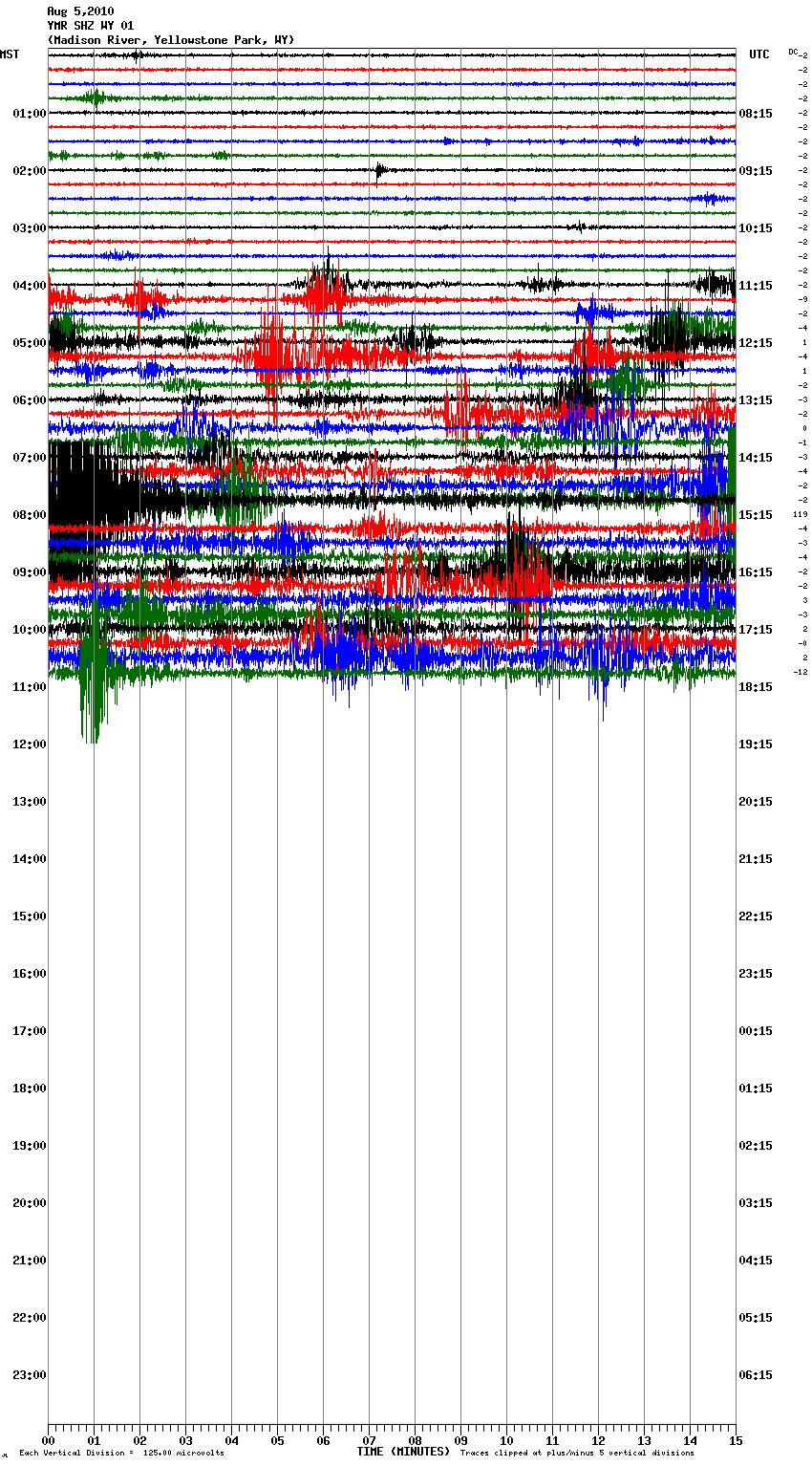
Quake Watch 2010
05.08.2010 um 19:34@spiky
Achsooo... haha ;D
Ja Wyoming isn Bundesstaat der USA.
Die YS Caldera befindet sich größtenteils in Wyoming.. eher kleinere Abschnitte befinden sich in Idaho und Montana. Liegt genau zwischen diesen 3 Bundesstaaten.
Im Jänner 2004 gab es in der Region ein 5.4 Beben..
das Beben ist nicht vulkanisch, da es sich nur in 5km Tiefe befindet.
Aber möglicherweise kam es wegen vulkanischen Tätigkeiten im Untergrund zum Bewegen der Caldera, und deshalb bebt es am Rand der Caldera.