Verschwörungen
Menschen Wissenschaft Politik Mystery Kriminalfälle Spiritualität Verschwörungen Technologie Ufologie Natur Umfragen Unterhaltung
weitere Rubriken
PhilosophieTräumeOrteEsoterikLiteraturAstronomieHelpdeskGruppenGamingFilmeMusikClashVerbesserungenAllmysteryEnglish
Diskussions-Übersichten
BesuchtTeilgenommenAlleNeueGeschlossenLesenswertSchlüsselwörter
Schiebe oft benutzte Tabs in die Navigationsleiste (zurücksetzen).

Was geschah mit Flug MH370?

54.918 Beiträge ▪ Schlüsselwörter: Vermisst, China, Flugzeug ▪ Abonnieren: Feed E-Mail
Zu diesem Thema gibt es eine von Diskussionsteilnehmern erstellte Zusammenfassung im Themen-Wiki.
Themen-Wiki: Was geschah mit Flug MH370?

Was geschah mit Flug MH370?

05.12.2021 um 18:33
Langsam wird es peinlich.

Glynn war Kapitän auf A330, B747 und B767. https://www.linkedin.com/in/michael-glynn-7784b912/?trk=public-profile-join-page

Für jedes Muster braucht man 3000-6000 Stunden, um Kapitän zu werden.

Ausserdem ist er Mitglied der https://www.russianroolettes.com/

https://www.google.com/url?sa=t&source=web&rct=j&url=https://www.youtube.com/watch%3Fv%3DPWjyeVkqzHM&ved=2ahUKEwjshIGml830AhWCR_EDHSUhAAM4ChC3AnoECBIQAg&usg=AOvVaw0DxwLSx60akiaWboD4RvMd

Anzeige
1x zitiertmelden

Was geschah mit Flug MH370?

05.12.2021 um 18:42
Zitat von Papaya64Papaya64 schrieb:Glynn war Kapitän auf A330, 747 und 767. Für jedes Muster braucht man 3000-6000 Stunden, um Kapitän zu werden.
Wo kann man diesen Werdegang nachlesen?
Vor August 2019 war er für Qantas nicht als Pilot sondern in einem Komitee tätig. Außer Militär, Kunstflug und vmtl. auch noch privat, kann ich keine weiteren Tätigkeiten als Pilot erkennen. Wenn es die gibt, immer her damit.
Mittels der veröffentlichten Karriere lässt sich (für mich) nur der Zeitraum von August 2019 bis Juni 2020 feststellen


melden

Was geschah mit Flug MH370?

05.12.2021 um 18:55
@Papaya64

Kapitän kann man immer dann werden, wenn Kapitäne gesucht werden.
Ein Kumpel von mir ist, als er die Airline wechselte, auch sofort dann als Kapitän eingestellt worden, obwohl er zuvor Copilot auf einem anderem Muster war.
Glynn wird die Suche nach Kapitänen ja mitbekommen haben, eine Umschulung jüngerer Piloten auf diese alte Möhre hätte sich vmtl auch nicht gerechnet.


melden

Was geschah mit Flug MH370?

05.12.2021 um 19:17
@Zz-Jones
Mike Glynn ist schon ein sehr erfahrener Captain mit über 18000 Stunden, ich find gerade die Seite nicht, war auch Kampfpilot usw. . Er hat sich schon früh nach dem Verschwinden auf eine Entführungs-und Suicidetheorie festgelegt.
Gibt dazu viele Zitate in diversen Medien …


4x zitiertmelden

Was geschah mit Flug MH370?

05.12.2021 um 20:05
@jerrylee2016
Das mit dem Kampfpilot weiß ich alles.
Mir ist aber Wurst ob er Pirouetten fliegen kann.
Mir geht es um Flugstunden, auf einem Passagierflugzeug, welches einer B777 zumindest dann aber auch noch nahe kommt (747?)

Diese 18.000 Flugstunden kann er nicht zwischen 08/19 und 07/20 angesammelt haben.
Einen weiteren relevanten Zeitraum konnte ich nicht entdecken (gerne lasse ich mich aber da eines besseren belehren). Ergo lautet meine derzeite Schlussfolgerung, es gibt wohl auch bessere Experten.
Zitat von jerrylee2016jerrylee2016 schrieb:Er hat sich schon früh nach dem Verschwinden auf eine Entführungs-und Suicidetheorie festgelegt.
Ja, der dürfte Godfrey nicht unbekannt gewesen sein.


melden

Was geschah mit Flug MH370?

06.12.2021 um 19:14
Godfrey hat auf diverse Fragen reagiert und seine Vorgehensweise bei der Berechnung am Flugende erläutert.
Es deckt sich ziemlich gut mit der von mir weiter oben gedachten Vorgehensweise.
So erklärt er dann auch, die zwei weiteren möglichen, jedoch aus seiner Sicht sehr unwahrscheinlichen Punkte und schränkt das Suchgebiet auf Max 270km2 ein.

Interessant:
https://www.mh370search.com/2021/11/30/mh370-preliminary-findings/comment-page-1/#comment-1220


melden

Was geschah mit Flug MH370?

06.12.2021 um 19:23
Er bestätigt auch, dass ATSB sich diesen Bereich nochmal anschaut - denkt jedoch, dass dies nochmal dauern wird.
Und tatsächlich hat die Dong das Gebiet abgesucht.

Kann jemand sagen, ob die dieses Gebiet mit der Schleppseiltechnik oder einer freien „Tauch-Such-Maschine“ geprüft haben?
Mir ist nicht klar, ob die nicht größtenteils mit Schleppseil gearbeitet haben. Ich halte dann das übersehen bzw. nicht entdecken für wahrscheinlicher, da bei den gescannten Meeresgrundoberflächen mit dieser Technik wahrscheinlich sehr häufig ein dichtes aufnehmen nicht möglich ist.


1x zitiertmelden

Was geschah mit Flug MH370?

06.12.2021 um 19:29
Zitat von MasijanimaMasijanima schrieb:Kann jemand sagen, ob die dieses Gebiet mit der Schleppseiltechnik oder einer freien „Tauch-Such-Maschine“ geprüft haben?
Das steht exakt in dem von Dir zitierten Blog. Antwort: beides, Tow (Schlepptau) und AUV (Autonomous Underwater Vehicle, "freie Tauch-Suchmaschine").
The ATSB led search then covered the location 33.177S 95.300E as part of Deep Tow operations on board Go Phoenix in Feb 2015. Within the 40nm radius of this point was continued Deep Tow coverage on board Go Phoenix until June 2015, data holiday coverage by Fugro Supporter AUV in April 2015, Deep Tow on Dong Hai Jiu 101 in July 2016 and AUV on Fugro Equator in November 2016.
Quelle: Wie von dir zitiert.


melden

Was geschah mit Flug MH370?

06.12.2021 um 19:44
Ok, sorry.
Ich war der Meinung, dass nur die Dong genau dort gesucht hätte.
Dass die Fugro das Gebiet mit AUV abgesucht hat, habe ich bis gerade nicht auf dem Schirm gehabt…


melden

Was geschah mit Flug MH370?

06.12.2021 um 20:00
Habe mir gerade noch mal den Film von fugro angesehen: https://www.fugro.com/mh370 (Archiv-Version vom 07.12.2021)
Wenn die in diesem Bereich wirklich mit dieser Auflösung alles abgesucht haben, kann MH370 da nicht liegen….


melden

Was geschah mit Flug MH370?

06.12.2021 um 20:18
Kann man z.b. hier
https://dapds00.nci.org.au/thredds/catalog/iy57/catalog.html
wirklich alle Aufnahmen einsehen?

Geht bei mir auf dem iPad gerade nicht….
Und das Ablagesystem habe ich auch noch nicht wirklich verstanden….
…nach fugro und auv kann man Dateien suchen, aber wie findet man die richtigen Koordinaten?


melden

Was geschah mit Flug MH370?

06.12.2021 um 21:42
Tja, das kann ich auch nicht erkennen.
Es handelt sich offenbar um fortlaufende Dateinamen.
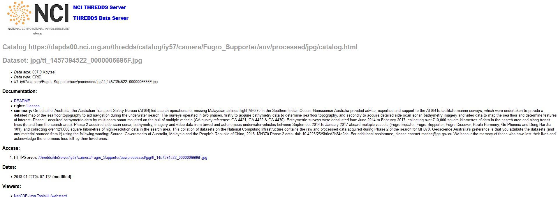
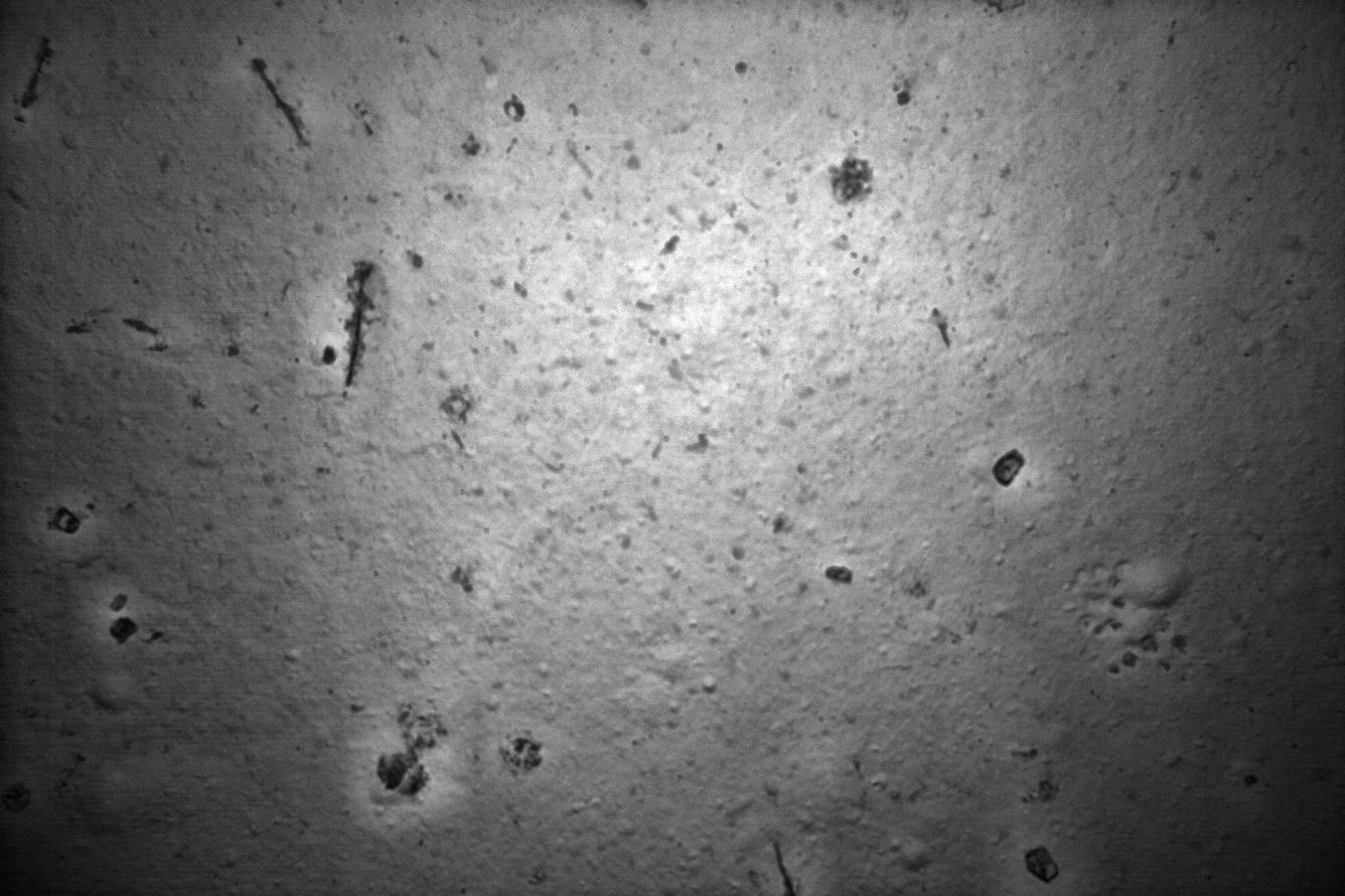
Die Erklärung gibt da auch nicht viel her, aber die Bilder haben eine gute Qualität!


example Summary JPG-DateienOriginal anzeigen (0,2 MB)

Quelle: https://dapds00.nci.org.au/thredds/catalog/iy57/camera/Fugro_Supporter/auv/processed/jpg/catalog.html


melden

Was geschah mit Flug MH370?

06.12.2021 um 22:15
Erstmal finde ich es cool, dass Ihr das gefunden habt, danke dafür!

Im Readme (Quelle siehe unten) wird einiges erklärt, es wird aber dauern, sich da einzulesen.
Read me (Phase 2 MH370 raw and processed data)


Please note that processed and raw data are intended for use by professionals and technical experts; accessing and working with them will require specialised training and software. For a general overview of MH370 Phase 1 and 2, please visit http://www.ga.gov.au/about/projects/marine/mh370-data-release. To visualise and download data sets, visit http://marine.ga.gov.au/#/ (Archiv-Version vom 16.03.2020).

Please note that the following Phase 2 datasets have been provided by third party organisations and that no edits have been made to the data or files provided, apart from reallocation of folder structures by Geoscience Australia.Note that not all files are searchable through the DB Query Search by Area tool at marine.ga.gov.au. Files which cannot be represented spatially, or those with specialised reader requirements will be unavailable. Please search for these files by attribute, or access these files directly through the National Computational Infrastructure via their THREDDS server (http://dapds00.nci.org.au/thredds/catalog/iy57/catalog.html)
--

Abstract:

On behalf of Australia, the Australian Transport Safety Bureau (ATSB) led search operations for missing Malaysian airlines flight MH370 in the Southern Indian Ocean. Geoscience Australia provided advice, expertise and support to the ATSB to facilitate marine surveys, which were undertaken to provide a detailed map of the sea floor topography to aid navigation during the underwater search. The surveys operated in two phases, firstly to acquire bathymetry data to determine sea floor topography, and secondly to acquire detailed side scan sonar, bathymetry imagery and video data to map the sea floor and determine features of interest.

Phase 1 acquired bathymetric data by multibeam sonar mounted on the hull of multiple vessels (GA survey reference: GA-4421, GA-4422 & GA-4430). Bathymetric surveys were conducted from June 2014 to February 2017, collecting over 710,000 square kilometres of data in the search area and along transit lines (to and from the search area).

Phase 2 acquired side scan sonar, bathymetry, imagery and video data from towed and autonomous underwater vehicles between September 2014 to January 2017 aboard multiple vessels (Fugro Equator, Fugro Supporter, Fugro Discover, Havila Harmony, Go Phoenix and Dong Hai Jiu 101), and collecting over 121,000 square kilometres of high resolution data in the search area.
--

Standard acknowledgements for use of data:

All material and data from this access point is subject to copyright. Please note the creative commons copyright notice and relating to the re-use of this material.

With the exception of the Commonwealth Coat of Arms and where otherwise noted, these products are provided under a Creative Commons Attribution 4.0 International Licence. (http://creativecommons.org/licenses/by/4.0/legalcode). Creative Commons Attribution 4.0 International Licence is a standard form license agreement that allows you to copy, distribute, transmit and adapt this data provided that you attribute the work.

Geoscience Australia's preference is that you attribute the datasets (and any material sourced from it) using the following wording: Source: Governments of Australia, Malaysia and the People's Republic of China, 2018. MH370 Phase 2 Raw and Processed data. doi: http://dx.doi.org/10.4225/25/5b0cd2b84a2dc

Geoscience Australia wishes to acknowledge the contributions of the Government of Malaysia, the People's Republic of China, the Australian Government, Fugro Survey Pty Ltd, SL Hydrospheric LLC, Sherrell Ocean Services, GK Consulting and the crews of the Go Phoenix, Dong Hai Jiu 101, Fugro Discovery, Fugro Equator, Fugro Supporter and the Havila Harmony.

For additional assistance, please contact marine@ga.gov.au

We honour the memory of those who have lost their lives and acknowledge the enormous loss felt by their loved ones.

--

Summary:

This collation of datasets on the National Computing Infrastructure contains the raw and processed data acquired during Phase 2 of the search for MH370.

The folder structure of the datasets by data type: 'camera', 'documents', 'gis', 'heave', 'mbes', 'nav', 'platform_raw', 'sbp', 'sidescan', 'sniffer', 'svp', 'tides', 'water_column', 'weather', with sub-folders separated by vessel or type, then raw or processed.

'camera' - This folder contains imagery and video in the following formats: .avi, .mp4, .smb, .jpg, .tfi, .tif, .gdb. These are records of video and imagery data from specific contact investigations during the search. The data were acquired by Remotely Operated Vehicles (ROVs) and Autonomous Underwater Vehicles (AUVs).

'documents' - This folder contains all contact investigation reports acquired during the search in .pdf format as well as metadata records detailing datasets as received by third party organisations.

'final processed' - This folder contains all phase 2 processed final version side scan sonar, synthetic aperture sonar, bathymetry, backscatter and hillshade datasets as supplied by third party organisations. These files are split by data type, with sub-folders separated by organisation/vessel and then file format.

'gis' - This folder contains derived geospatial datasets including contact locations, coverages, data holiday database and generalised trackline of deep tow and autonomous underwater vehicles.

'heave' - This folder contains raw heave records for some vesssels in .csv, .mcom, and .srh formats. These are records of the vertical ship motion.

'mbes' - This folder contains raw and processed bathymetry, backscatter, combined and hillshade files for the hull-mounted and Autonomous Underwater Vehicle mounted multibeam echo sounders (mbes), in the formats: .tif, .png, .xtf, .txt, .laz, .xyz, .bil, .all, .gsf, .gdb, and .xyi. This folder also contains processed multibeam echo sounder .csar and caris files. These are viewable on the free software CARIS Easyview, available from the CARIS website: www.caris.com under Free Downloads, or on the full version of CARIS HIPS and SIPS. Additionally, the folder also contains raw EdgeTech native file format (.jsf) for Fugro Equator.

'nav' - This folder contains raw and processed navigation files for vessels, deep tow, autonomous underwater vehicles (AUV), remotely operated vehicles (ROV), position and Ultra Short Base Line (USBL) data acquired (kml, kmz, .shp, .txt, .xix, .dxf, .pos

'platform_raw' - This folder contains .raw files from Fugro Equator. Specialised programs are required to read read raw multibeam data and are listed here, however, this list is not exhaustive: Caris, MB-System and Fledermaus.

'sbp' - This folder contains sub-bottom profiler, .seg and .sgy files derived from Kongsberg-specific system Simrad SBP 300 suite frequency ranging from 2.5 to 6.5 kHz. This data, when acquired, was acquired simultaneously with the multibeam datasets and can be used to inform shallow geological characterists below the seafloor.

'sidescan' - This folder contains processed and raw side scan sonar and synthetic aperture sonar data captured via deep tow and autonomous underwater vehicle (AUV) systems. Data varies in format by vessel and supplier, with formats including png, tif, img, xtf, gdb, jsf.

'sniffer' - This folder contains sniffer data acquired by various vessels throughout the search. The HydroC™ Subsea Fluorometer sensors recorded the presence of polycyclic aromatic hydrocarbon concentrations by measuring fluorescence emissions in the water, potentially indicating the presence of aircraft grade petroleum hydrocarbons.

'svp' - This folder contains ascii files of sound velocity profiles acquired using a Kongsberg system (.asvp) that measure the speed of sound through the water column, and are used to correct bathymetry measurements.

'tides' - This folder contains tidal correction data supplied by Fugro, utilising the Starpack platform.

'water_column' - This folder contains .wcd files acquired using Kongsberg EM302 (30 kHz) that describe the acoustic return of a target or targets within the water column. This data was acquired intermittantly during the survey. This file is used commonly by CARIS Hips and SIPS, Fledermaus and Echoview.

'weather' - This folder includes various weather related data acquired during the survey, including weather observations, windspeed, barometer, pitch, roll, heave, temperature and miscellaneous video observations.

The data is supplied in a number of coordinate systems and projections, including: WGS84 (decimal degrees), UTM-84 Zone 45S, UTM-84 Zone 46S. In most cases, file names will be labelled with the corresponding projection; if not, it can be assumed to be WGS84.

An example of the directory structure is below:

camera
-> Dong_Hai_Jiu
-> rov
-> processed
-> avi...
-> mp4...
-> smb...
-> Fugro_Equator
-> auv
-> raw
-> jpg...
-> tfi...
-> tif...

The folder structure of the final_processed datasets are as follows: 'visualisation5m', 'sidescan', 'mbes', and is sorted by data type, with sub-folders separated by vessel, data format.

An example of the directory structure is below:

visualisation5m
sidescan
->ss
->fugro_combined
->deeptow
->xtf_roames
->xtf
->tiff_roames
->gdb_5m
->gdb_1m
->auv
->xtf_roames
->xtf
->tiff_roames
->gdb_5m
->gdb_1m
-> sas
->GoPhoenix
->Shifted_Line_Sections
->Replay
->png_tif_5m
->png_tif_1m
->DongHaiJiu
->png_5m
->png_1m
mbes
->hillshade
->Fugro_combined
->deeptow
->auv
->tiff_roames
->gdb
->bathymetry
->GoPhoenix
->xyz
->tif
->Fugro_combined
->deeptow
->las_xyz
->gdb
->auv
->las_xyz
->gdb
->Dong_Hai_Jiu
->xyz
->png
->backscatter
->GoPhoenix
->xyzi
->png_tiff
->Fugro_combined
->deeptow
->png
->las_xyi
->gdb
->auv
->png
->las_xyi
->gdb
->Dong_Hai_Jiu
->xyzi
->png

For processed datasets
visualisation5m - an enhanced high-resolution colour image that represents sidescan with backscatter appended in the nadir with a false-colour ramp. Note that this is only an image for visualisation products and does not contain data.

The data is supplied in a number of coordinate systems and projections, including: WGS84 (decimal degrees), UTM-84 Zone 45S, UTM-84 Zone 46S. In most cases, file names will be labelled with the corresponding projection; if not, it can be assumed to be WGS84.

--

To perform bulk downloads of the data, we recommend filtering files using the 'File_Links.txt' file in the root folder, and then downloading using a command line utility like wget. For example, to download sidescan files, the Linux commands would be:

grep sidescan File_links.txt > sidescan_links.txt
wget -x -i sidescan_links.txt

For Windows users, we recommend using a Linux emulator (e.g. Cygwin - http://www.cygwin.com) to perform these tasks, or alternatively, a program such as wget for Windows (http://gnuwin32.sourceforge.net/packages/wget.htm).
Quelle: https://dapds00.nci.org.au/thredds/catalog/iy57/catalog.html?dataset=iy57/READ_ME.txt


melden

Was geschah mit Flug MH370?

06.12.2021 um 22:20
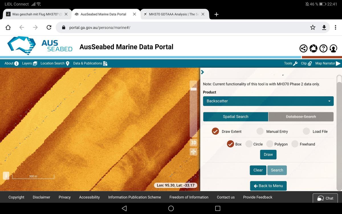
Auf die Schnelle scheint es, als könnte man mit diesem Frontend nach Region suchen
https://portal.ga.gov.au/persona/marine#/


1x zitiertmelden

Was geschah mit Flug MH370?

06.12.2021 um 22:21
Man muss die Dateien downloaden.
Hab's nur bei einer jpg-Datei probiert, funktionierte.
Viel interessanter wären die avi-Dateien, die sind nur leider viel zu groß.


tf 1431305625 0000000237FOriginal anzeigen (0,3 MB)


melden

Was geschah mit Flug MH370?

06.12.2021 um 22:25
Das Problem ist leider, dass uns die Positionen der Schiffe nicht viel bringen.
Wir müssen schon genau wissen, wo die Schleppsonare oder die AUVs überall waren.


melden

Was geschah mit Flug MH370?

06.12.2021 um 22:30
Aber falls jemand Interesse hat, größtenteils jeweils über 2,1GB runterzuladen, bitte schön:
https://dapds00.nci.org.au/thredds/catalog/iy57/camera/Dong_Hai_Jiu/rov/processed/avi/catalog.html


melden

Was geschah mit Flug MH370?

06.12.2021 um 22:44
Ich habe es jetzt geschafft, mich in dem Tool zu der von Godfrey benannten Stelle durchzufinden, aber ich kann die Daten nicht erklären.
Screenshot 20211206 224159 com.android.cOriginal anzeigen (1,3 MB)


1x zitiertmelden

Was geschah mit Flug MH370?

06.12.2021 um 22:49
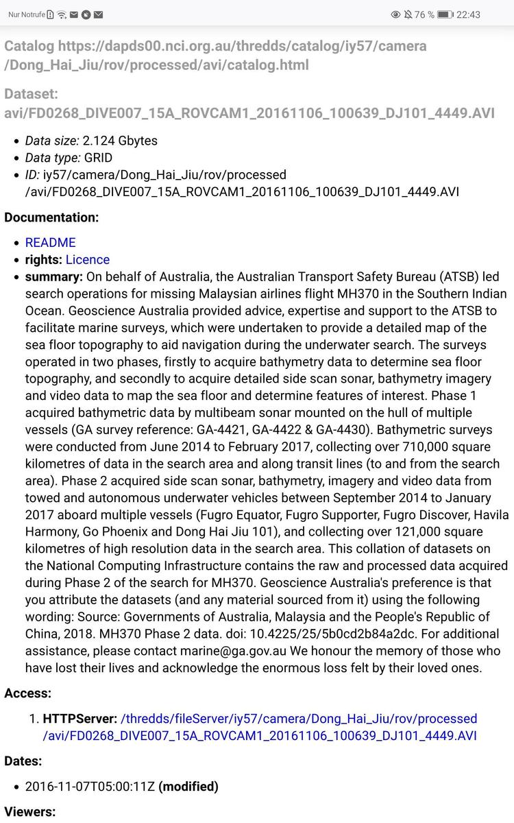
Wenn man jetzt z.B. im vorigen Link die erste Video-Datei der Dong anklickt, sieht man folgendes:
Screenshot 20211206 224315 org.mozilla.fOriginal anzeigen (1,3 MB)

Unter "Access: HTTPServer:" lässt sich diese Datei dann downloaden.
Negativ fällt jedoch "modified" auf


melden

Was geschah mit Flug MH370?

06.12.2021 um 22:52
Die Frage ist doch, wie man das Material zu bestimmten Koordinaten findet.
Solange wir nicht verstehen, was genau modified bedeutet, brauchen wir uns darüber noch keine Sorgen zu machen.


Anzeige

melden